Drone Maps Demystified: A Practical Guide to Improving Mapping from Above

Drone Maps Demystified: A Practical Guide to Improving Mapping from Above
What we learned from our recent webinar sessions with Nick Coelho (Bermuda Zoological Society) and Naz AL Hafid (Mayfield Garden, NSW, Australia) regarding the use of Drone maps for botanic gardens.
Watch the full recording: both sessions plus the combined Q&A.
Why a good map is the backbone of collection management
The smooth operation of any botanical garden relies on knowing what plant material you have and where it is. Accession records tell you what you have. A map tells you where, and the where is usually where things fall apart.
A map turns a spreadsheet of accessions into something you can actually stand in front of. It gives spatial context to a collection: how plantings relate to one another, where gaps are opening up, how a bed has filled in over five seasons, and which specimens sit closest to a path or a boundary. For day-to-day work, that spatial layer is what makes records usable rather than merely complete.
Maps also help on many practical levels that are easy to underestimate:
- Orientation for new and seasonal staff. A new starter or intern can find an accession on a good map without a two-week apprenticeship in "the garden's geography."
- Navigation and remote planning. You can plan a work route, a planting plan, or a removal programme from your desk before anyone sets foot in the field.
- A shared reference. Curators, horticulturists, and researchers all point to the same base map rather than arguing from three different mental models of the site.
Naz's team at Mayfield Garden in New South Wales benefitted from the new aerial maps straight away. They moved from Computer Aided Design (CAD) Software to Hortis in late 2024, and their new aerial drone maps integrated with their plant records had a significant impact in how the garden was able to operate.
The problem with free, generic maps
To get started with mapping, the logical first step is to reach for a free basemap, such as OpenStreetMap, Bing Aerial, or similar. It's free, it's already there, and in many cases it works satisfactorily. For a lot of gardens, that's a perfectly reasonable place to begin.
However, many institutions quickly find the free maps too limiting, in particular those with herbaceous planting for the following reasons:
- Lack of detail. Free satellite imagery is captured for the whole planet, not for your garden. Resolution is coarse; you're looking at a canopy blob where you need to see individual specimens. Mayfield found that Google imagery simply wasn't sharp enough to accurately place plants.
- Geolocation drifts. Generic imagery can sometimes be offset from its true position. When you're assigning GPS coordinates to individual accessions, an imagery offset means every plant you place inherits that error.
- It's out of date, and you can't control when it refreshes. You can't choose when the satellite passes over. A bed replanted last spring may still show bare soil or the previous planting. For a collection that changes every season, a static, outdated basemap is frustrating.
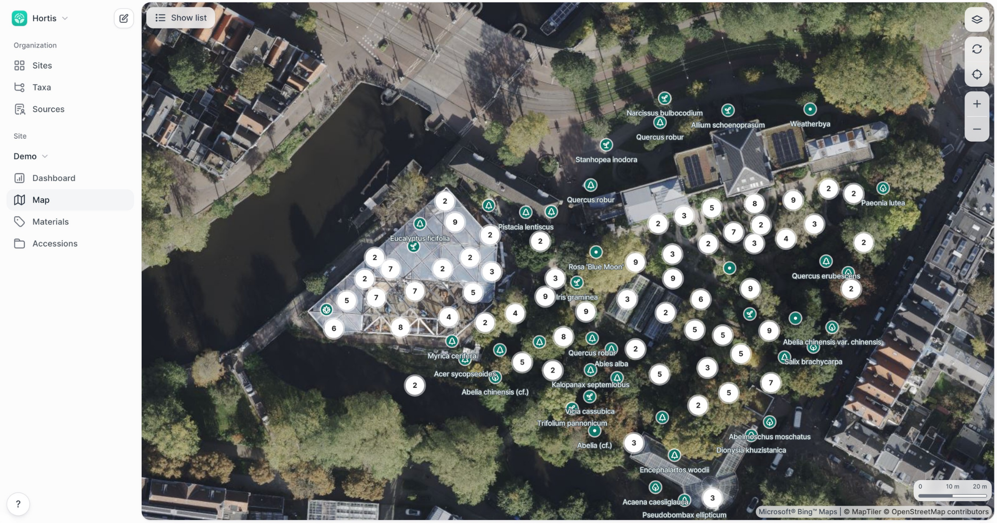
Free maps are a fine place to begin. But, if you value spatial accuracy and up to date records, then a drone map might be your best option.
What drone mapping can actually give you?
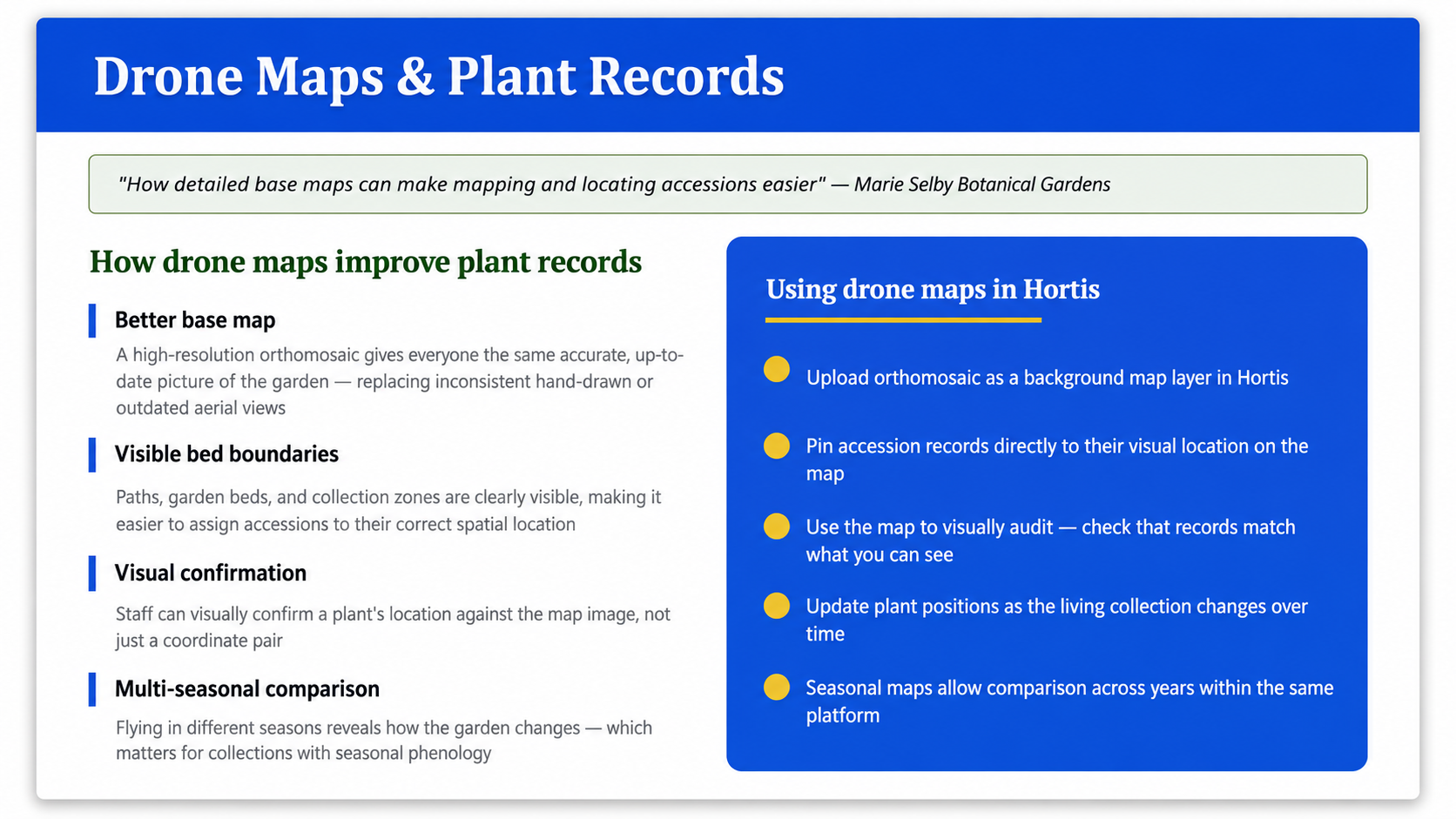
A drone flight produces an orthomosaic: hundreds or thousands of overlapping photos stitched and geometrically corrected into a single, accurately-scaled map imagery. When done properly, it addresses the shortcomings mentioned above and adds capabilities that generic imagery simply lacks.
Resolution you can work with. In open areas, drone maps can reach 1–2 cm per pixel, sharp enough to see and place individual plants rather than guessing from a green smear.
Accuracy you can trust. With an RTK (real-time kinematics) unit for precise GPS positioning, drone maps are typically more accurate than satellite imagery. That accuracy flows straight into your plant records: place a specimen on an RTK-corrected map, and the coordinates are genuinely reliable.
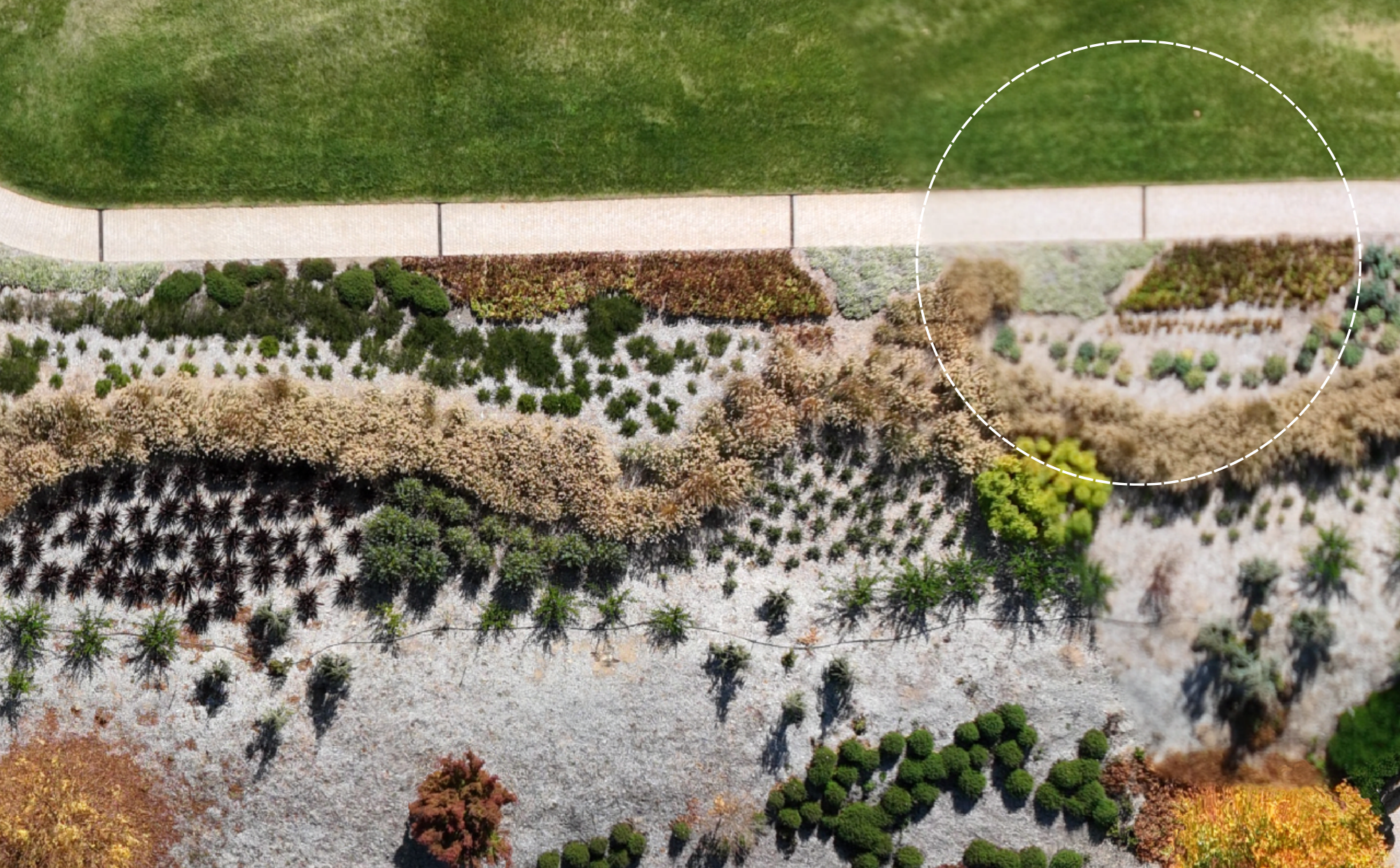
A base layer for everything else. In Hortis, the orthomosaic can serve as a base layer beneath the records. New accessions are placed on real imagery of the actual site, allowing staff members to navigate and plan workflows and changes remotely.
Control your flight schedule. Unlock seasonal mapping, before-and-after maps of the same bed across seasons, track how plantings fill in, monitor invasive-removal programmes, and document construction or landscape changes as they happen.
Plant health you cannot see with the naked eye. Multispectral sensors capture data beyond visible light. Using indices like NDVI, a drone can detect stress, damage, or decline before it's visible from the ground. Nick's team has used this to assess hurricane damage and to help distinguish native from invasive vegetation.
However, one must keep in mind that a drone map is not a plant-identification tool. It gives you an excellent base map and can provide genuine plant-health data, but telling species apart from aerial imagery still requires trained expertise. Drone mapping complements collection management; it doesn't replace the eye of a professional.
The honest challenges
The adoption of Drone Technology does not come without its challenges. The recurring difficulties are:
- Dense canopy. Gardens are not like open fields. A closed canopy hides everything beneath it, and flying under one is genuinely hard. In the tropics, an evergreen forest canopy offers little relief. In temperate regions, though, seasonal timing helps: a leaf-off flight in winter or early spring can reveal what a summer flight cannot.
- Wind, weather, and coordination. Flights need suitable conditions, which can mean real scheduling friction. Wind affects both flight and image quality.
- Public access and airspace. A garden open to the public constrains when and where you can fly. Proximity to airports or other regional restrictions imposes time and ceiling limits on flight altitude.
- File sizes and processing. High-resolution maps can quickly become very large. Larger projects can be hundreds of gigabytes in size and can take many hours to process. Bermuda Zoological Society has accumulated over 4 terabytes since 2021. Cloud-based processing (e.g. DroneDeploy) helps manage large datasets, but storage and processing time are real planning factors.
- Learning curve. Both the mapping software and the flight side take time to get comfortable with, so don’t be too ambitious to start with.
The checklist: Commissioning a drone map
Whether you're hiring a vendor or building in-house capability, this is the practical checklist distilled from both sessions. Nick's headline advice: start with one small, well-defined site rather than a large, complicated one. Test the workflow on something manageable, then scale up.
1. Define the job before you fly
- Purpose. Base map for records? Seasonal change tracking? Plant-health monitoring? Invasive-removal or construction documentation? The purpose drives every specification below.
- Site and scope. Start with a single, contained site. Note total area and any obvious obstacles (canopy, structures, water).
- Repeat cadence. One-off, or seasonal/recurring? If recurring, you'll need consistent settings each time so maps align.
2. Specify the map (give these to your vendor)
- Ground Sample Distance (GSD). The real-world size of one pixel. Target 1–2 cm/pixel for detailed garden mapping. This is the single most important number — it determines whether you can see individual plants.
- Flight height. Lower height = finer GSD, but more images, longer flights, more processing. Mayfield found 70–100 m sufficient for their needs; open, detailed work runs lower. Balance resolution against flight time and file size.
- Overlap. Gardens need higher overlap than agricultural mapping because of height variation and dense vegetation. Confirm your vendor sets front and side overlap accordingly — under-lapping causes stitching failures. Nick recommends 80%-85% overlap.
- RTK positioning. Ask specifically whether they fly with RTK for accurate GPS. If your records depend on coordinate accuracy, this is non-negotiable.
- Multispectral (optional). Only if you want plant-health/NDVI data. It adds cost and complexity — skip it if you only need a base map.
3. Confirm regulatory and access logistics
- Local regulations. Check any general restrictions on operating drones in your area.
- Airspace/ceiling limits. Check proximity to airports and any altitude restrictions before booking.
- Licensing. Confirm the operator holds the appropriate drone certifications for your jurisdiction.
- Public access. Plan flights around opening hours and visitor safety.
- Weather window. Build in schedule flexibility for wind and conditions.
4. Plan for the data
- File size and storage. Expect large files, potentially tens to hundreds of GB per high-res map. Confirm where they'll live.
- Processing. Cloud platforms (e.g. DroneDeploy) handle big datasets and long processing times better than a single workstation.
- Output format. Request a GeoTIFF — a georeferenced image file that drops straight into GIS and collection software as a base layer.
5. Get it into your records
- Check alignment. Before assigning planting locations, confirm the new map overlaps correctly with your existing basemap. Misalignment might mean re-positioning of plant material. Check first.
- Inspect quality. Scan for blurry patches, distorted areas, and visible seam lines before you rely on it. Re-fly problem areas if needed.
- Integrate the base layer. Load the orthomosaic onto a compatible map hosting service and load the base map into Hortis. Resource: How to Add Base Maps in Hortis.
Hardware, Software and Tooling
Making the map (Hardware and processing)
- Drone options — BZS flies DJI enterprise-level drones (from ~$5,000 USD), paired with an RTK unit (~$2,000 USD) for the GPS accuracy that makes records reliable. DJI dominates this space, but it isn't the only option — and if you're commissioning a vendor, the drone is their decision, but you only need to confirm they can hit your target GSD. If you're buying in-house, treat the drone as one part of a system (drone + RTK + processing software) rather than a standalone purchase, and start with a comparison guide rather than a single recommendation.
- DroneDeploy — cloud-based flight planning and processing; handles large datasets and multispectral/NDVI analysis, with results in the browser and no heavy local hardware. Used by Nick's team for mapping and 3D models.
- WebODM / OpenDroneMap — open-source and free to run; capable of survey-grade output with good capture and ground control, but requires the most technical setup. Came up in the Q&A.
Other alternatives worth mentioning
- Pix4D — professional desktop/cloud photogrammetry with a range of application-specific products (e.g. Pix4Dfields for vegetation/agriculture); high accuracy, popular in survey and research contexts.
- Agisoft Metashape — desktop photogrammetry favoured in academic and research settings; a one-off purchase, strong on multispectral processing and custom workflows, but with a steeper learning curve.
- DJI Terra — processing optimized for DJI drones, a natural fit if you're already flying DJI hardware.
Using the map (GIS Tools)
- QGIS — free and open-source, the most common starting point for gardens; loads GeoTIFFs directly, huge plugin ecosystem, no licence cost.
- ArcGIS (Esri) — the industry-standard commercial platform (ArcGIS Pro on the desktop, ArcGIS Online in the browser and map publishing); powerful and widely supported, but subscription-based.
- GeoServer — open-source server software for publishing map layers so others can access them over the web; relevant if you want to host your orthomosaic for staff or the public rather than just view it locally.
- OpenAerialMap — a public, open platform for sharing and discovering aerial and drone imagery, run by the Humanitarian OpenStreetMap Team. Where GeoServer and ArcGIS Online let you publish imagery on your own terms, OpenAerialMap lets you contribute your orthomosaic to a shared commons that anyone can search and use — a good option if you're happy to release your map under an open licence (CC-BY 4.0) and want it discoverable alongside imagery from around the world.
- Hortis — we offer a paid hosting service for your aerial base maps, if neither of the hosting options above are available to you.
Is Hortis a GIS tool?
Hortis is built on a spatial database and includes GIS capabilities focused on the needs of botanic gardens, drawing bed polygons, placing plants on the map, and positioning accessions using integrated GIS tools, rather than advanced geospatial analysis. You can bring an orthomosaic in as a base layer and do the spatial work of running a collection directly, without the complexities and learning curve found with general purpose GIS tools.
The One-line takeaway:
Free satellite basemaps are a fine place to start, but if spatial accuracy, currency, and plant health matter to your records, a drone-flown orthomosaic, commissioned with the specs above, turns your map from a rough backdrop into an integral and important part of your collection management workflow.
Q&A
The Q&A is at the end of the recording, which you can jump to here.
About our presenting institutions
A huge thanks to Nick Coelho (Bermuda Zoological Society) and Naz AL Hafid (Mayfield Garden, NSW, Australia) for sharing their work.
Bermuda Zoological Society
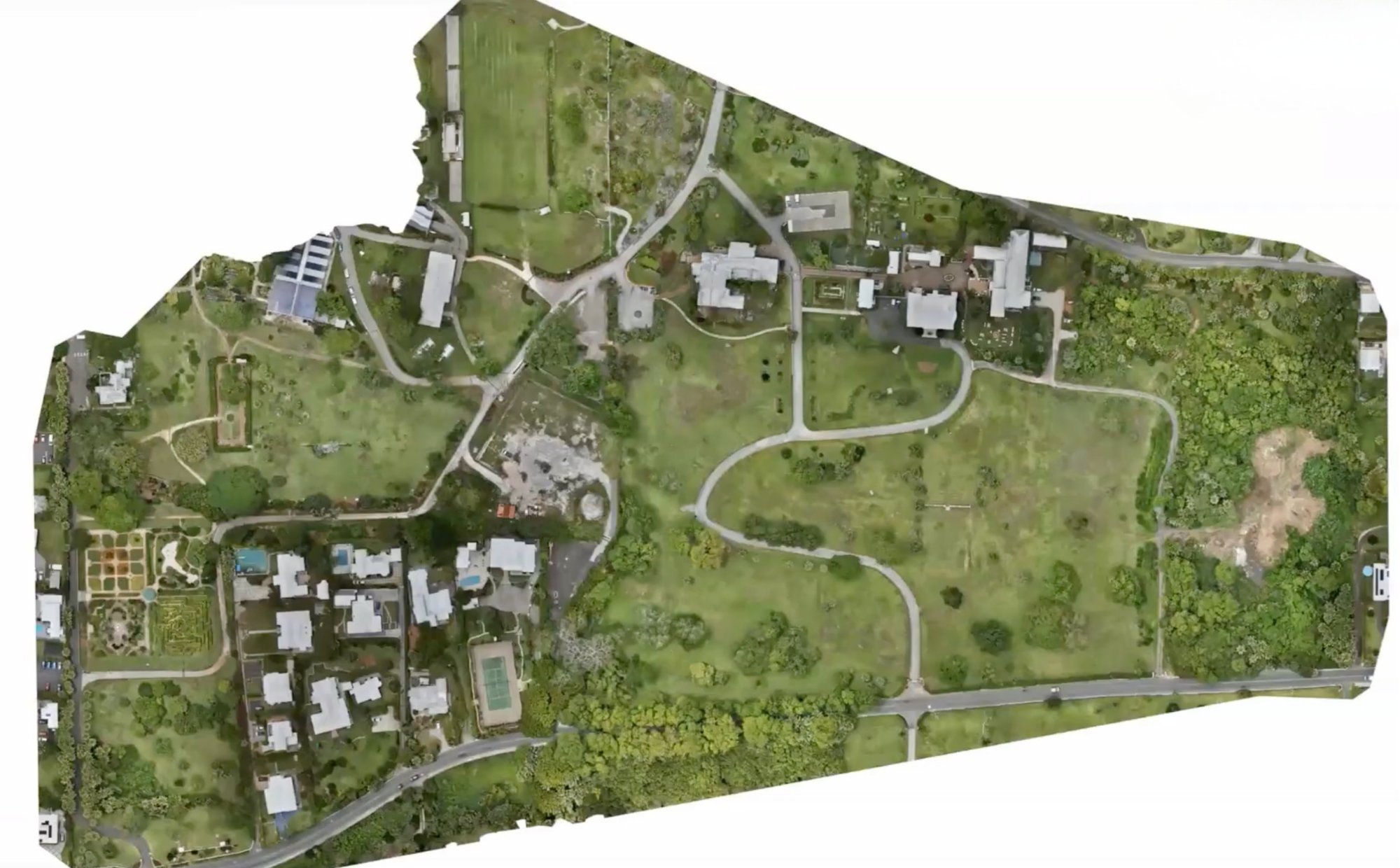
The Bermuda Zoological Society (BZS) is the charity that supports the Bermuda Aquarium, Museum & Zoo, blending science education with hands-on conservation across the island. Its Micro Forest Project, launched in November 2021 and the source of most of Nick Coelho's mapping work, uses the dense-planting Miyawaki method to turn small, invasive-dominated or underused plots into self-sustaining native forests. Since inception the project has established more than two dozen micro forest sites across Bermuda, planting thousands of native and endemic trees and shrubs, removing well over 100,000 invasive plants, and drawing on 2,500+ community volunteers. Drone mapping is now one of the project's core monitoring tools, used to track ecosystem health across the growing network of sites — the work Nick shares in this webinar.
Learn more at bzs.bm.
Mayfield Garden
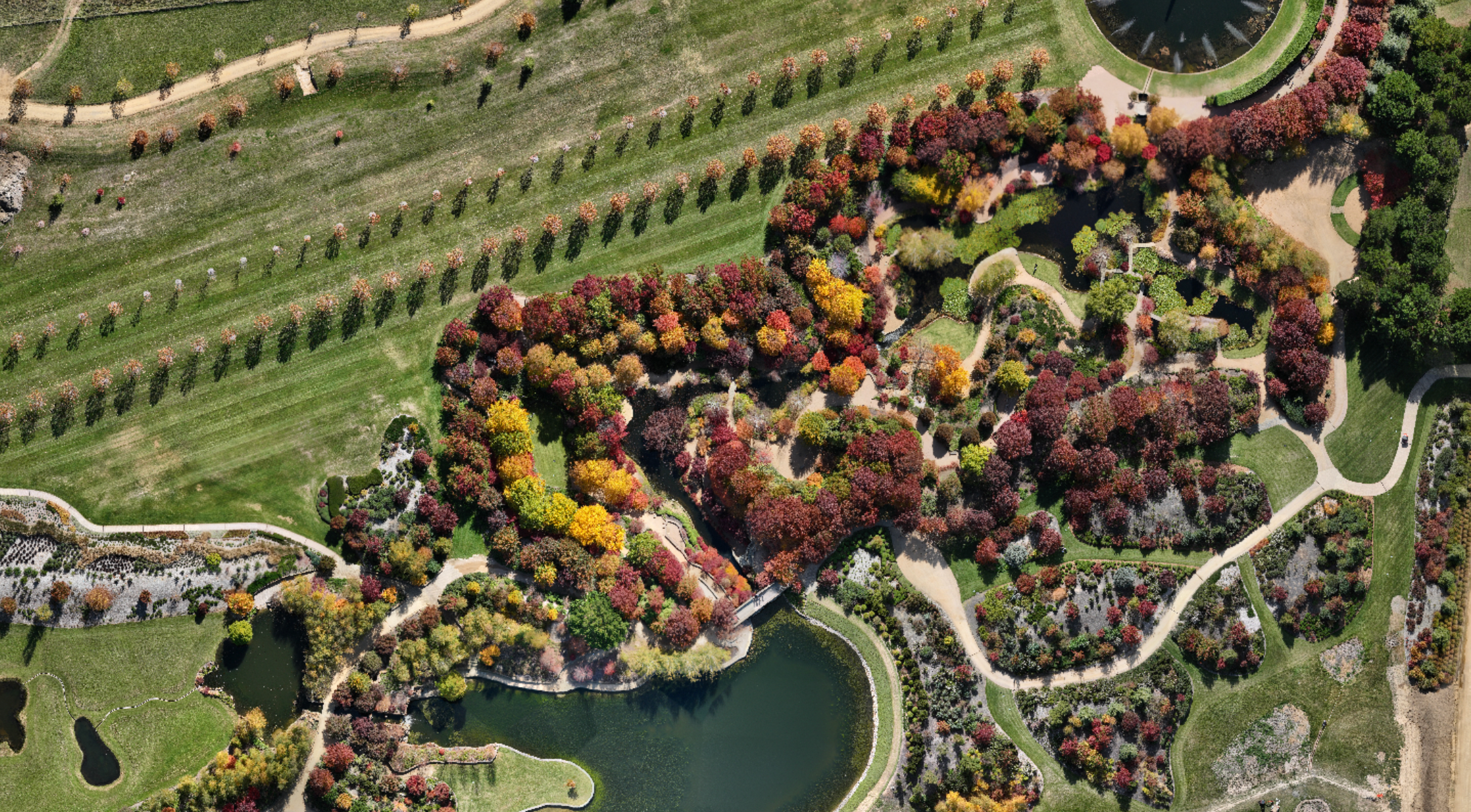
Mayfield Garden sits at Oberon in the Central Tablelands of New South Wales, about two and a half hours west of Sydney, and is one of the world's largest privately owned cool-climate gardens. Owned and developed by the Hawkins family since the 1980s, the garden spans a large estate within a working farm, with themed landscapes, water gardens, valleys, groves, and formal plantings, that shift dramatically across the seasons. That seasonal character is exactly what makes it a compelling drone-mapping case study: as Naz described in the webinar, Mayfield moved its plant records from CAD into Hortis in late 2024 and now uses seasonal drone orthomosaics as an accurate, up-to-date base layer for accessioning and navigation.
Learn more at mayfieldgarden.com.au.