Newsletter: July 2023


Our engineering team has grown, and so has Hortis – bringing you a host of new features based on your feedback.
This month, we introduced enhanced tag filtering, user deactivation, support for recording IPEN numbers, and the ability to load custom maps. Read more about July’s highlights and how they can help your garden.
Enhanced tag filtering: Now spanning Taxa, Accessions, and Plant Materials
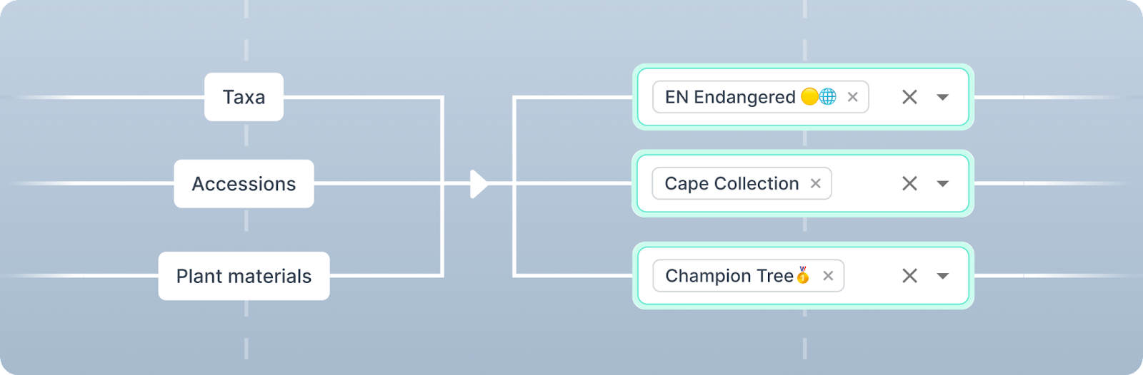
Previously, tags were limited to individual record types, restricting list and map search results to the specific record type where the tag was applied. Now, filter results will show tags applied from all levels, providing a more interconnected view of your plant records.
For example, filtering for a tag applied to a taxon will return the associated accessions and plant materials. Filtering for a tag applied to an accession will return the associated plant materials.
By filtering tags that are applied across all levels, you can more easily find associated accessions, plant materials, and taxonomic information, on both the list and map views.
Deactivating users
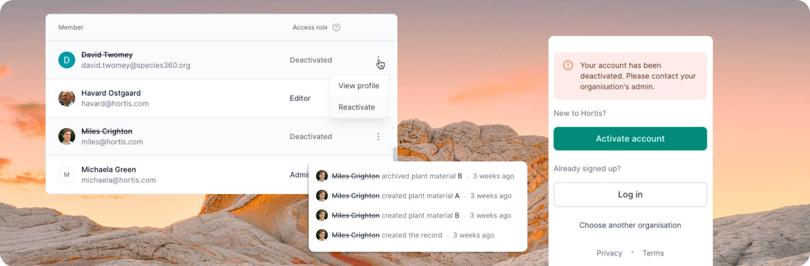
Admins now have the ability to deactivate users to prevent access to their organisation. Admins can also reactivate a deactivated user's account. Any deactivated users will be visually indicated throughout the app.
This new functionality provides better control over user access, ensuring a secure and optimised environment for your team.
IPEN numbers (and other opt-in fields)
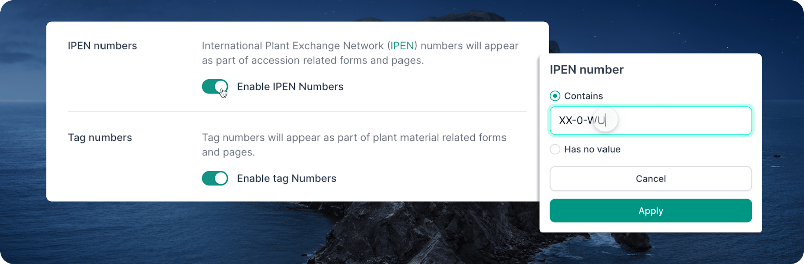
IPEN numbers can now be recorded and filtered on the accession. This has been introduced as an "opt-in" field (along with Tag Number), with easy toggle controls for these fields in your Collection Site Settings.
With the new opt-in toggles, you can now choose to hide fields and inputs that are not relevant to your site's specific requirements. This customisation reduces clutter and ensures a more intuitive user experience for sites that do not utilise IPEN numbers or Tag Numbers.
Custom base maps
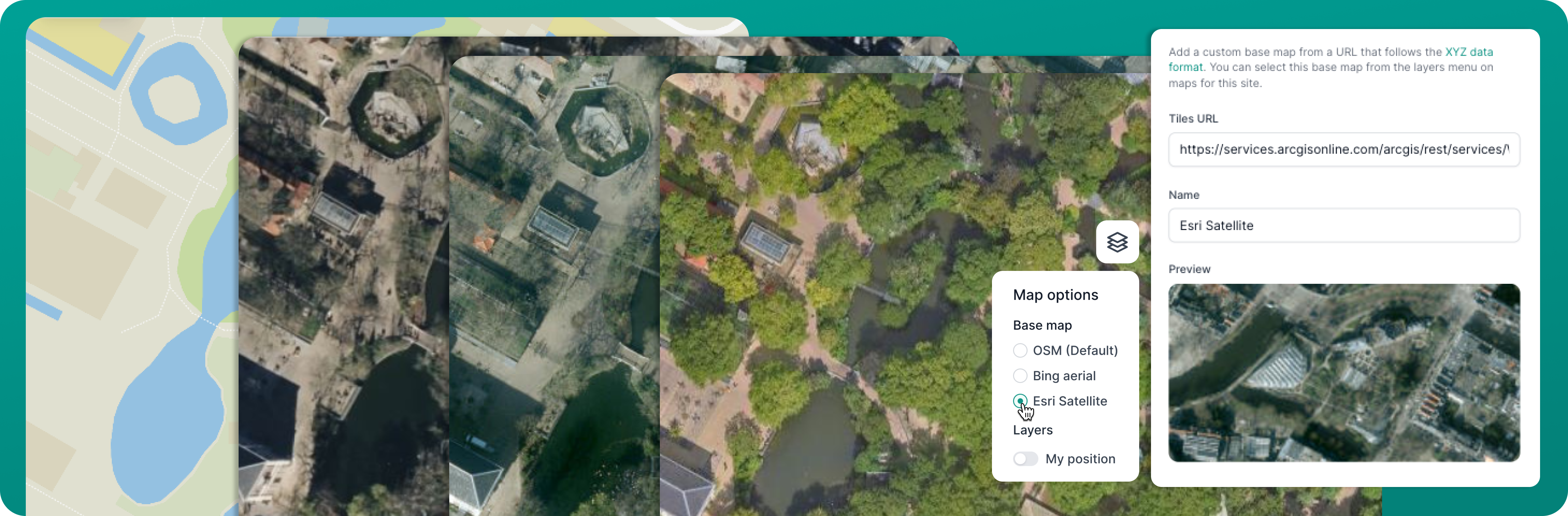
You can now add other base map layers or your own custom map layer to Hortis. Easily set a tile URL and a name to your custom map, and use the preview function to visualise and ensure its accuracy. Switch to the new layer whilst browsing the map or positioning of your materials.
By integrating map layers into Hortis, you gain access to a wide range of existing base maps, and even more significantly, the ability to incorporate your very own custom map layers. Whether you wish to visualise topographic data, historical vegetation trends, or even drone-generated imagery of your garden, XYZ Maps lets you do just that. For more general information on XYZ maps, head to this link.