Newsletter: June 2022

In June, our focus was on finalising mapping and photos, among the most requested features, so they could be made available to all users. We also had time to add a number of other useful capabilities, including the ability to delete accessions and plant materials, and show the full audit log for updates to plant material records.
Don’t forget to read our “tip of the month” at the end of the article, which relates to using the mapping features.
Images are here for everyone
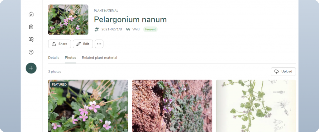
The ability to add and edit photos is no longer experimental and is now available to all users. Add photos by uploading on a desktop or using your smartphone’s camera directly. You can now also tag the “Featured” photo, which will be displayed on the header for the plant material.
Featured photos will later play a role in other parts of Hortis, so we recommend you consider choosing your favourite photo every time you add or edit photos.
Full release of mapping with satellite base layer option
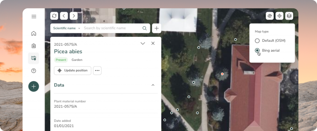
Mapping is now fully released to all users. View your garden map, assign new coordinates to your materials, and update the position of any existing material marker – all directly from the map.
You can now also use a satellite base map layer (Bing Maps) to view the map of your garden. Switch between the two available layers (the default layer is provided by Open Street Map) using the layers menu in the top right. This will help you to be more accurate when mapping your plant material locations.
See changes with the Activity Log
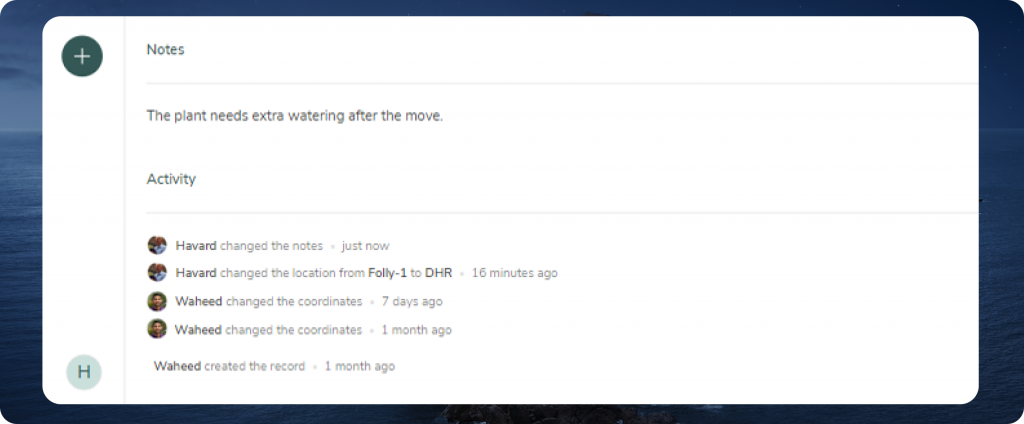
A list of all the changes made to plant material is now found at the bottom of the record. You can hover over the entry to get the exact time of when the changes were made.
The activity log utilises the Hortis audit trail, allowing users to see all the changes that have been made to the plant collection data. This allows you to more easily understand which changes have been made, when and by whom – in the future, there will be the possibility to revert or correct mistakes in a robust and traceable manner.
Deleting accessions and plant materials
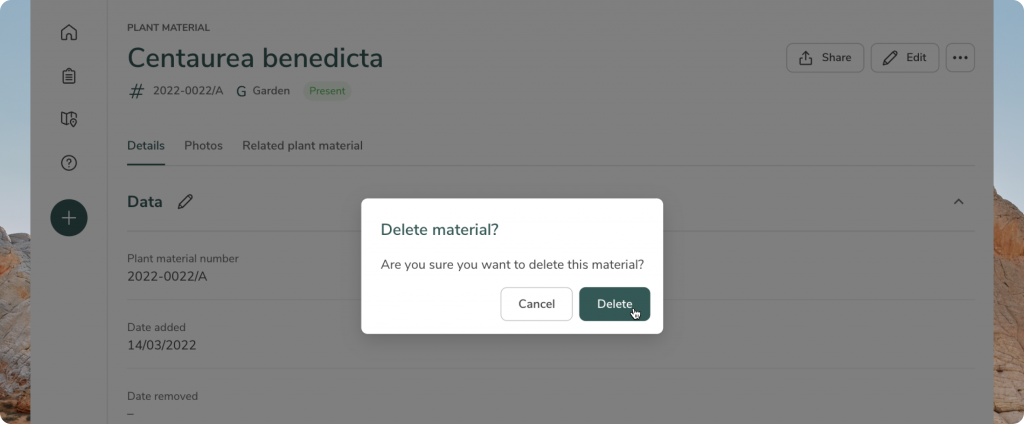
You can now delete accessions as well as individual plant materials. To do this, click the […] button at either the accession or plant material, and select “Delete”. Accidental deletions can always be recovered.
Other highlights from June
Access the complete list of all the updates by heading to our Release Notes Page.
Tip of the Month
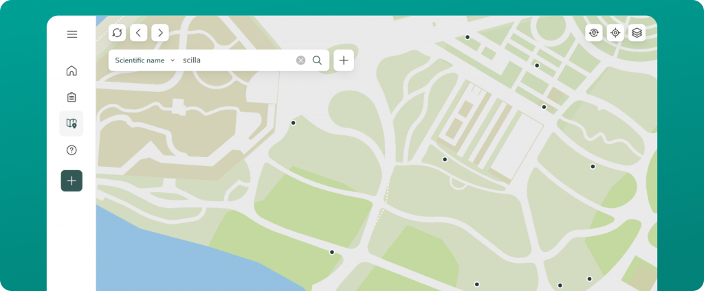
Did you know you can search your collection from the map? Our search bar utilises the same search algorithm as in the List View of your collection, giving you a lot of flexibility when searching your collection from the map. This applies to both scientific names as well as accession numbers. Meaning that you can carry out much of your work directly from the map. Why not give it a try?
What’s coming next?
Our priorities for July are to add further audit log capabilities elsewhere in the app, as well as to make improvements to the way you can tag collections of accessions and plant materials.